The best route optimization from Asia to EU
We are delighted to announce that our project, Ocean Bulletin for Green Digital Shipping Corridor, has been selected by the European Space Agency call for maritime decarbonisation to make the best use of satellite data to reduce maritime transport emissions. Thanks to our technology for merging multiple satellite observations, we will provide the best weather and ocean forecasts for the main shipping routes of the Green Digital Shipping Corridor between Singapore and Rotterdam (Figure 1).
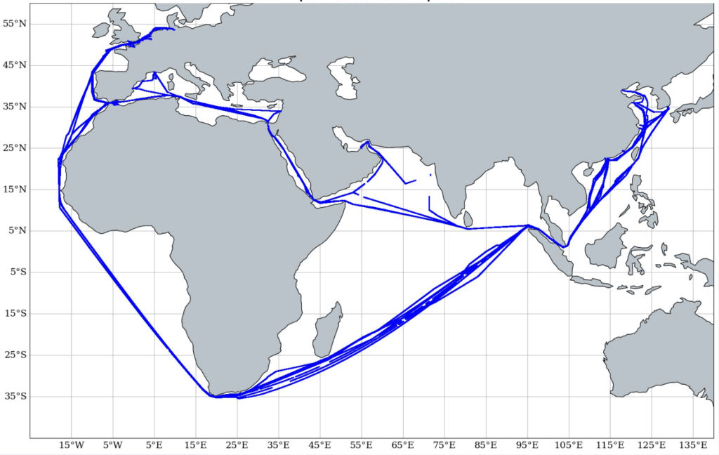
Figure 1: Examples of routes traveled in one year by a container ship between Asia and Europe.
Thanks to partnerships with numerous shipping companies (CMA-CGM, Eastern Pacific Shipping, Orange Marine, GENAVIR), we will be able to use navigation data from many ships to validate the quality of our forecasts in the Indian Ocean and the China Sea.
This project also aims to develop a whole range of new features on our Ocean Bulletin web platform to make the best use of this new high-resolution weather and ocean data to plan and optimize ship routes along this Green Corridor.
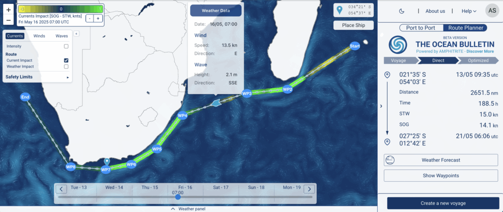
Figure 2: Interactive web platform Ocean Bulletin
Our preliminary analysis indicate that short-term optimal routing can reduce fuel consumption by 8% to 10% over a week when ships take the southern route and round the tip of South-Africa via the Cape of Good Hope.